Sunday, September 5, 2010

Yellowstone Grand Canyon. The last day in the Park

I was surprised that, after a long and busy day on Wednesday that we were up and around not long after 7am and off to the park around 9. The road we have to take has significant construction activity including a paving project and rebuilding a wall on a narrow and winding section. Signs tell you to expect a 30 minute delay. We were lucky going up as we only waited a couple of minutes, but had about a 20 minute wait on the return (I took a quick nap!).
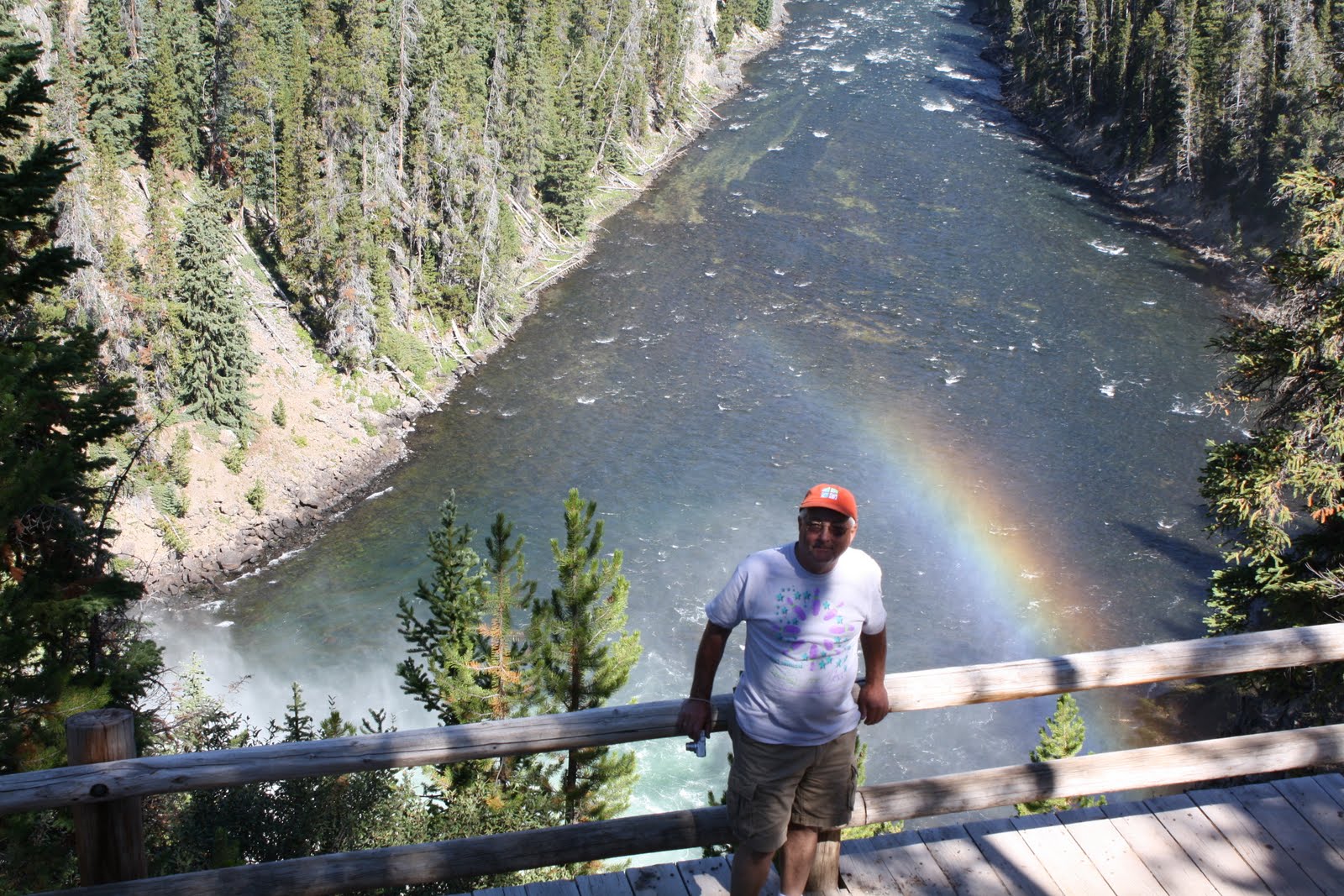
Our last day in the Park (might also have been Renee's last day as she is getting ready to pack up and head south in the next couple of weeks) is to visit the Grand Canyon of Yellowstone. It is pretty much in the center of the park and is spectacular. There are several waterfalls, but the most accessible are the Lower Falls, and that, of course also means lots of people.
We took a couple of side trips on the way and saw this bison just wandering down the road with no particular objective that we could see.
Did we break the 75 ft rule or did he? There was not 75 ft available!!

Once we reached the parking area there are several alternative trails that lead to better views of the canyon and the Falls. We hiked along the South Rim, it is about a mile or so each way with varying terrain but good (if sometimes loose) underfoot. 


There is a trail that Renee has taken that goes down in to the canyon, Uncle Tom's trail. It is short and steep descending about 500 ft in to the canyon with some 300 steps as well as steep downhill sections.As the information says. Easy going down but strenuous coming back up. I wimped out, and we took the trail that went along the South Rim with great views and more people. 


This tree is about to head in to the canyon. Maybe this year, maybe next.

We stopped and ate our lunch along the way and enjoyed a relaxing day that I would have otherwise missed. 
We arrived at Artist Point after a while and there was another parking lot there with lots of people. The view is all the way back up where we had hiked to the falls and gives a great perspective of the size and grandeur of the canyon. 


We headed back and, as mentioned sat in the traffic for a while, and then came across some elk grazing along a river bank with the now expected parade of cars and watchers. We participated. 
Once out of the park we stopped again at Renee's favorite spot on the Madison River just outside West Yellowstone. It is a magical place.

Enjoy

Saturday, September 4, 2010

Yellowstone Round 3. Driggs ID, Jackson WY, and South Yellowstone

Wednesday's continuing saga.
After Bechler falls we headed south (maybe south east) towards Driggs ID. Why you could rightfully ask!. Renee had heard there was a decent restaurant at the airport (I am always a sucker for a $100 hamburger) and a chance to see some WW2 vintage aircraft. The airport is remarkably big and busy with big hangars and good facilities including a 7000 ft runway. Someone explained that it is a less expensive alternaitve  to Jackson WY (Jackson Hole) on the other side of the range.
Lunch was excellent and there were 4 or 5 airplanes of interest so the trip was a success.
To get there we traveled through wheat and barley fields on grid roads that ran 180 degrees and either 90 or 270 degrees down to a highway and on to Driggs. I saw a sign for Kaufman Tire in Driggs. My son Alistair works for a Kauffman Tire Co in Atlanta. Not the same outfit in any way but worth a photo to generate comment!.

I am not sure what defines remote and compared to some places like the Dakotas but it is a long way from a big town. Driggs is on the western side of the Grand Tetons and in this pleasant agricultural valley.
The drive from Driggs and Victor is up across a pass that is steep and short (in western terms). Numerous warnings about hot brakes on trucks, and the consequences are dire. The truck runaway ramps are a LONG way away and you just do not want to do that.
Jackson is a nice town I am sure , but is crowded and full of the sort of people I do not like and I am sure they would rather I moved on as quickly as possible. The Grand Teton (AKA The large boobs) National Park is to the north and adjacent to Yellowstone. It is just north of the Jackson Hole Airport that looks like it would have a challenging and interesting approach, although not as much as Lukla in Nepal or Courcevel in France. (both are still on my list to experience)
Grand Teton Park is not as extensive as Yellowstone, but the sights are majestic (the eternal search for superlatives!).


 The highest peak is 13,770 ft and that puts it approx 6450 ft ft above the valley where I was taking the photos. There is still some snow in the very protected areas of the mountain. I wonder if you looked at photos from say the '60s whether you would see more snow, and maybe some visual evidence of global warming. Just a thought.


We looped around on a short road that took us to Jenny Lake in the park and it provided some great views as well.


Last view of the Grand Tetons from the north end across the Jackson Lake
It was already about 5.30pm and we were still about 150 miles from home, and it was not interstate!
The road north is a 2 lane road and the strictly enforced speed limit in National Parks is 45mph. There is a short gap between the parks, but it is a part of a National Forest.


Renee and me at the WY entrance. Photo courtesy of a couple from Virginia.

We re-entered Yellowstone, this time from the Wyoming side and headed up past Lewis Lake (after the Lewis and Clark expedition member) and the edge of Yellowstone Lakethe largest in the park.
On this road you will cross the Continental Divide three times, once at 7988 ft (2435m) once at 8391 ft (2558m) and again at 8262 ft (2518m). At some point (and I am not certain where) we came across temporary signs that stated "No Stopping for next mile" and of course around the curve there were cars stopped, some in the middle of the road.
There was a lot of animal activity, but the star of the show was a wolf who was wading around in the river. He was on his own and probably a couple of hundred yards away.
Looks almost like a bear. He was wearing a tracking collar (Renee's photo)


Headed up the creek (Renee's photo)
 
We saw other animals, particularly some bison that were wandering along the roadside at dusk. Not an encounter you want to have with a vehicle as they are LARGE.
The final event of the day was my joining the CDPC. For the Caterpillar folks who are reading, no this is not some random distribution center (in the Cat sense anyway) but the Continental Divide Peeing Club. Started by Renee a couple of months ago and I became the second member (as it were!) at the 8262 ft location. 
 
Clearly the photos is an "after" shot as I look distinctly relaxed!
We drove out of the park around 9pm and had been through entrances to the park in all three states. I suspect few know of the entrance from Idaho. 
We reckon that we drove around 350 miles that day. It was tiring but totally worth it and we gained a day to visit "The Grand Canyon of Yellowstone" That will be the next post.
 I am hoping to get current over this glorious Labor Day weekend. 

Wednesday, September 1, 2010

Yellowstone Round two.

The original idea for this day was to visit the Mesa Falls in Idaho (near Ashton ID), then go in to Yellowstone from Idaho and hike to Bechler Falls (it is about 1 1/2 miles from the parking area).and then have a long day on Thursday going down to Jackson Hole Wyoming and the Teton National Park. We got an early start so ultimately decided to go on to Driggs Idaho as Renee said there was a collection of WW2 vintage aircraft (and a good place for lunch), and we could then loop around through Jackson and come back through the Wyoming Yellowstone entrance and out of the Montana entrance (or exit if you prefer). So we would have been in the park from all three states that it resides in.
It was a long day but totally worth it as it allowed us to spend Thursday at Canyon, another great area of Yellowstone.
The Mesa Falls are on a loop road off Highway 20 that goes from West Yellowstone to Ashton and on to Idaho Falls. You come first to the Upper Falls and they are not particularly well marked, or rather there is only one sign, and if you miss that you have to turn around. Fortunatly Renee had been before and knew what to expect. 
The Upper Falls are about 144 ft high and there is an excellent walkway to get to the best viewing sight and while it is a climb it is easy with good footing.
The falls are very impressive and throw off some mist that helps create rainbows. Very pretty. 


 The far wall is covered in grasses 
and moss from the constant moisture and way high in one of the trees is an eagle' eyrie. There is a set of binoculars at the Visitor Center that is fixed and focused on it. We were there around 9 am and there were some other people there but not many. 


The view down river from the Upper Falls


We headed on around the loop to the Lower Falls, which were much further away. They are "only" 65 ft high but seem to go through a more constricted gap and are (in my mind) equally impressive.
Lower Mesa Falls. Viewed from about 1/2 mile away.


The ever present GOCA hat at Lower Mesa Falls


We moved on to Warm River where the road crosses a bridge and there are a concentration of fish (various variety of trout). A family came along suitably armed with bread and it was obvoius that the fish were used to this and performed accordingly!.
There was a small house right by the river and a bigger fancier lodge across the street. rather liked the small house and it's location nestled in to the hillside.
Nice little house on the Warm River

A little way down the road you take a curve and suddenly burst out into a huge valley of very productive farmland and a complete contrast to the last few hours. This area is known (at least to the cognoscenti or those that read the signs) as a major area for growing seed potatoes.
As I go back 40 years or more to my classes in crop management I recall that crop rotation was important and you did one year of wheat, one of barley and one of a root crop like potatoes
I think this originated as a way to prevent the spread of disease and to not overtax the soil. I am equally sure that things have changed but that this quite green farming method is still in use today. That is what the evidence suggests.
We headed to the only entrance to Yellowstone from Idaho. It is about 10 miles up a fairly rough gravel road (not rough by Zambian standards!) to the Cave Falls. There were about 6 or 7 cars there and I think some people would have been off hiking some of the many trails as there were not that many people at the Falls. 
The last time Renee was at the falls there was a cave that you could enter, but the entrance had collapsed at some point in the past couple of months. 
Our plan was to hike to Bechler Falls, as Renee had not been and it was only 1.4 miles away (and described as an easy level walk). 

There were (again) several cars at the trail head and a sign indicating that it was possible to walk all the way to Old Faithful some 30+ miles away. We were not going that far!

Renee at Cave Falls

It was a very pleasant walk and a rudimentary trail with lots of trip hazards. We saw one guy fly fishing in the river just below the confluence of the Bechler and Falls rivers and another person (probably his partner) fast asleep in the woods!!
Can you spot the sleeper?


There was in fact a gentle upslope and the trail moved away from the river after about a mile or so. We followed up the Bechler river trail and eventually could hardly hear the river for 5 minutes or so and then heard a very different sound (no, not a bear!, but the sound of the falls rather than the river running) Right around the corner were the falls and very beautiful they were and well worth the hike. 
Renee Looking the part of wildlife photographer!

Bechler Falls
Down river from Bechler Falls

There was another fly fisherman (he was from West Virginia) who claimed he was not having much luck fishing with crickets and thought the cricket was too big for the fish!!


I think we got back to the car around noon and decided to extend the trip to Jackson WY at that point after a stop in Driggs Idaho.
I will do the Driggs and Jackson Hole portion as a separate post as this one is already long!!
I am only a week behind at this point, but will get caught up gradually.


Friday, August 27, 2010

Earthquake Lake. The power of nature

Earthquake Lake was formed overnight by a 7.5 Richter scale earthquake around midnight on August 17 1958.A total of 28 people lost their lives that night but the quake also moved around 80 million tons of rock from the side of the canyon into the bottom and to the other side of the canyon.
It successfully dammed the Madison River below the Hebgen Lake dam. Check it out on Google Earth. There were lots of tourists and campers as it was the height of the summer season, and the rescue efforts were underway by 11 the next morning. I think that is remarkably quick. It had to be as the water was rapidly rising and there was concern that it could impact the Hebgen Dam adding to the problems.
  This is the view looking west (direction of flow) 
This side is where most of the rock ended up. You can see the river in the center.


The large rocks in the next pictures came from the horseshoe shaped area in the center of the picture
Me in the picture for scale!!
 
Looking back to the East


Looking down the river (west) from the destroyed campground
A destroyed building at the campground


A significant section of Highway 287 that runs through the Gallatin National Forest was also destroyed making the evacuation all the more challenging.
The Army Corps of Engineers had to create a spillway which still exists today. It is gradually eroding and the water level today is about 70 ft down from the peak right after the quake. The belief is that it will eventually erode and the Earthquake Lake will disappear. 
There is (of course) more information at the website. Follow the link. Earthquake lake info
We also found time to go to West Yellowstone for groceries and gas, and stopped at Renee's favorite spot on the Madison River. She says that on a calm day the reflections of the mountains (correction HER mountains) are beautiful. I for one believe her!!

Renee at the Madison River. Renee's Range in the background!!


Yellowstone Part One

I arrived here in West Yellowstone on Sunday afternoon (it is now Friday) It was raining cool and windy, but with better weather forecast for the rest of the week.
My (excellent) host Renee was cooking ribs and had invited some of the other folks from the campground over for supper. Renee had another guest Beth Wagner. All three of us had worked together at Caterpillar in Clayton NC and then gone our separate ways. I will create a special post about Renee and my admiration for her lifestyle and choices.
Beth had been here for a few days and was due to leave for Bozeman on Monday evening for an early Tuesday flight. 
We decided to go into Yellowstone on Monday to see the geysers and of course the most famous one, Old Faithful. I have to admit that I have done little planning for this whole trip but particularly for this portion. Renee has been here since late May and has spent many days in the park so knows it well and also the best time of day for visits. 
It was quite foggy when we got up and the campground is right by a lake. I took a couple of photos that have the peaks of some of the mountains peaking out. Renee claims they are HER mountains so I will call them the Renee Range. I could hear a coyote on the other side of the lake, but could not see him or her through the mist. Rather cool! 
I have also posted a picture of the same range after the fog had cleared so you can see the magnificent view on a clear day. Superb.


Renee's Place

We left for the geysers early Monday morning and traffic was light. The only hold up was a "parade" which is when all the cars stop (sometimes in the middle of the road) to look at animals.
We experienced this within the first hour although there were few cars.


I have never seen a bison (live) so this was an interesting experience all the more so for a close up experience. Park rules do not allow you to get closer than 75 ft from animals other than bears and wolves, and then it is 300 ft. Plenty close if you ask me.
We arrived around 8.45 at the geyser field and Renee checked the estimated times for the various geysers to blow so we could begin to plan a route. There are about 150 geysers and they are spread out over about one square mile. All are well signed and some are certainly more spectacular than others. It was a partly cloudy day and quite cold when the wind blew and the sun was behind the clouds. 
We first went to Daisy Geyser as it was the first to erupt and she did so right on time. As you can see below it is difficult to photo the geyser against a white cloud background!


GOCA hat sighting

Renee and Beth at Daisy Geyser 
We spent the next few hours wandering around some of the other geysers and saw Old Faithful erupt from the lodge near by. It seems to have the most regular and predictable eruptions but is actually not as spectacular as Grand Geyser. The challenge with Grand is that they give you a 4 hour window of when they predict it will erupt, but the eruptions last between 7 and 12 minutes and are worth the wait. There are people who are Geyser Gazers and spend a LOT of time looking at them or waiting for them to erupt. The older ones are actually known as Geyser Gazer Geezers!!  

 We got back around 7pm after a full day and Beth still had to drive to Bozeman. Plans are for a short day tomorrow with a trip to Earthquake Lake!!