Friday, September 10, 2010

The Payette River Valley, Boise and barges.

I think I mentioned that I was going to visit Bill Gray in Boise. He and I worked together on some projects in those dark days when I actually worked!!


Seed corn with "Bull rows"


Bill grew up in the Snake River valley and we took some time to drive around and see the vast areas of farmland and on Monday went up to McCall ID about 90 miles north and in the high country. I think we discussed the production of seed potatoes, and I also saw hybrid seed corn being grown. The idea is that there is a hybrid synergy when two different breeds are "mated". This is done by having 3 or 4 rows of the corn that will become seed, and one row of the other variety that indiscriminately distributes it's pollen in a mid western fit of unsafe corn sex!!.
The hybrid synergy only lasts for the first season so farmers who use the corn have to buy new seed every year!. Very cunning and a great way to keep the price up I suspect. I am not sure if the "Bull row" is removed prior to harvesting but I think it is highly likely.
That is probably more than you wanted to know about growing corn and corn sex in general!
Pretty much all of the NW  part of the US drains into the Columbia River that drains in to the Pacific just west of Portland Oregon. Some of it's tributaries are the the Boise, Salmon, Payette and Snake Rivers. I saw all of them and in Idaho and Montana. 
Confluence of the Boise and Snake Rivers close to the Oregon State Line.
 The Snake and Columbia Rivers are navigable for barges all the way to Lewiston Idaho well to the north of Boise. It is an important and green way to transport bulk products like corn, potatoes, and alfalfa to their markets. Barges have two hulls and haul fuel up river and ag products back down. Ther are some environmental objections to the dams on the Columbia River but there is no doubt in my mind that the vision of the leaders back in the 30s who conceived the projects and implemented the building. was broader than we would see today. It opened up huge areas of the country to agricultural development and some prosperity to an area that needed it certainly at that time.
I guess I got a little off track with that, but I have been concerned that the blog was becoming a travelblog and was lacking commentary. Maybe this is back!  
Bill and I also headed up the Payette River valley on Monday towards Cascade and McCall ID. Boise is about 2800 ft elevation and McCall is over 5000 ft with a distance of approx 90 miles (may have said that already) 
Payette River near Smiths Ferry.


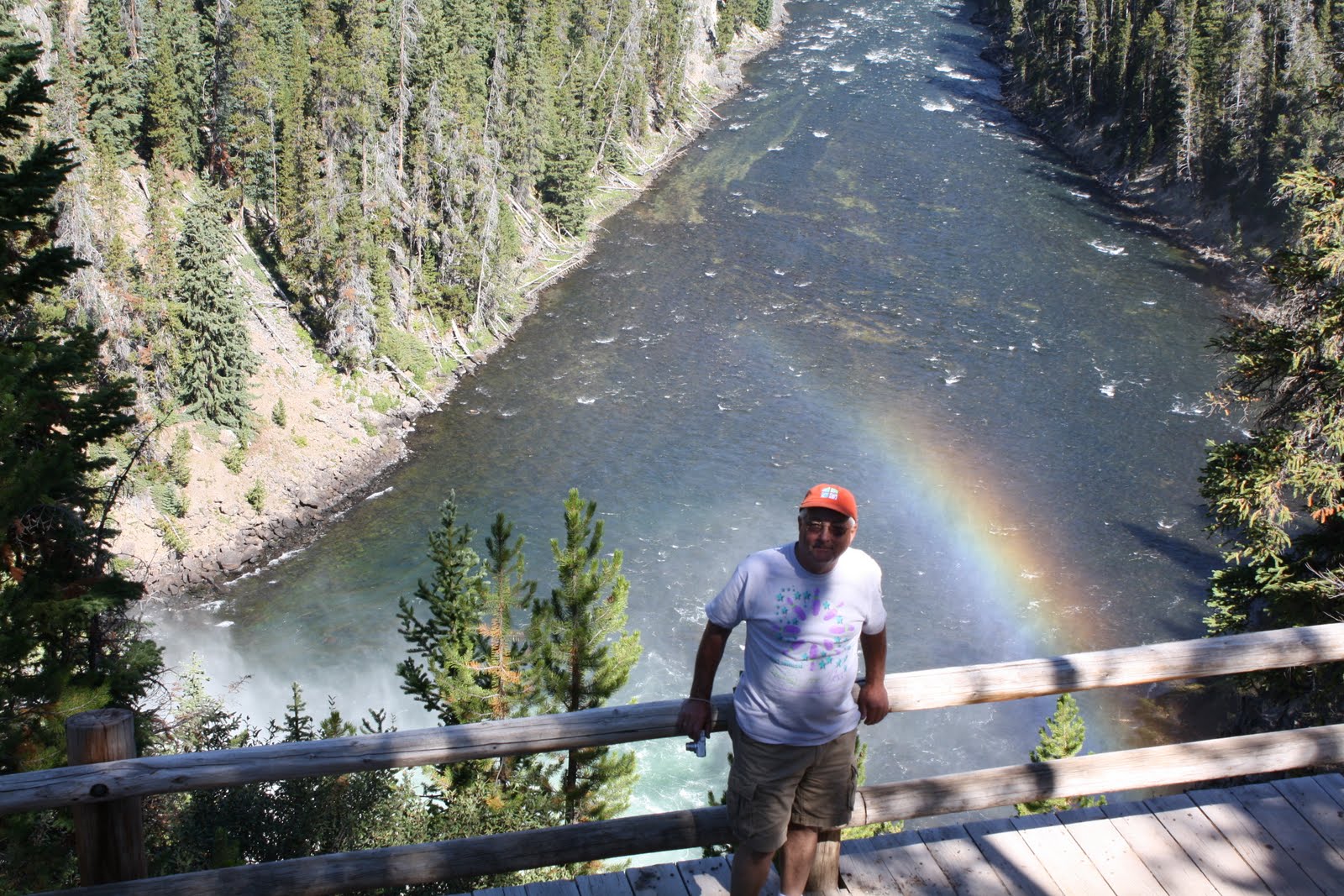
My friend Bill by the Payette River

 
Wonder what sort of clients they are trying to attract!!
 

They should have signs like this one in more states!

Again it is a beautiful and twisty road with occasional flat arears and small lakes on the river and then fast running water just around the curve.
We reached Cascade ID and had a late breakfast, but passed the airport just as we came in to town and there was much evidence of firefighting teams and both fixed wing and rotary aircraft used for fire fighting.


McCall is a small town on a lake that is a very popular weekend getaway. It looks prosperous and I suspect has a significant retiree population as well. It sits on the south end of a lake and there are some very beautiful homes along the lakeside.


We headed over the watershed in to the Weiser River valley and came back down to Boise that way. The scenery was not as interesting although we did see one place that looked like it had an airport control tower and a forbidding entrance and signs that were not conducive to a friendly welcame. We kept going!
We made a brief visit to Nyssa Oregon, mostly so that we had been to Oregon. There was an old sugar beet processing plant there and not too much else. It was a truly depressing place as any industry there was is gone and there is almost nothing left. That appears to be true of many small towns in the west and mid west where smaller family farms once ruled but the mega farms have taken over and reduced jobs and distributed wealth. I would say that in somewhere like Mud Lake or Nyssa you were either fairly wealthy and a significant employer or poor and a worker, very likely Hispanic judging by the stores and general appearance.
We headed back to Boise and I parted company with Bill as I had a very early flight the next day and stayed by the airport.
This was an interesting and very enjoyable trip, but the first part was very different from my NZ and Australia travels as I was in a rental car and did not get a chance to meet and talk with people as I had become accustomed to on the Antipodean trip.
I am home for a while with a possible trip to Guatemala in November to learn some Spanish. I will recrank the blog at that point.
Thanks for reading and commenting on my oddesy ,


Wednesday, September 8, 2010

Last days, and the ride to Boise.

Friday was an intentionally quiet day as I knew I had a long drive Saturday back to Boise. Other than a foray in to West Yellowstone for lunch we basically vegged out and caught up on blogs Facebook etc. In the evening there was a nice farewell to a couple who had worked and lived at the campground through the summer and were headed back to Texas. I me several people who were full time RV rs. One had been doing it for 10 years and the other 8 years. They both had 5th wheel units that are described as "triple slides" that basically expand sideways from the roading width. Typically pulled behind a diesel powered F250 or F350 truck. They have a permanent address somewhere, either a family member or a company that specializes in that (typically in a state with not state taxes!!).
I am a traveler but am not sure that is the life for me, but have respect for and interest inhow they live their lives.
Saturday was time for thanks and farewell and I left around 9 for Boise. 
I am on the way to see my long time friend Bill Gray who was in a past life a Cat dealer salesman in California specializing in sales to local governments. He is from the Boise area and moved back about 4 years ago. I have seen him once since then.
Bill worked on Saturday and I timed my arrival for after he got back from his current job with Direct TV.
I did not have a specific route in mind other than trying to stay off Interstate Highways. I headed down through Ashton ID and down to Rexburg all of which is fairly flat farmland and fertile farmland. I then headed west on Rt 33 towards Arco and off into some open rangeland and close to desert like ground conditions for 25 miles or so and then arrived at the teaming metropolis of Mud Lake ID!!. It is basically an intersection and some farms but is remote and must be a depressing place to live and work. Who the hell would name a place this?


I think this says it all


The road pushes on through Howe and eventually to Arco. On the south side of the road is the "Idaho National Laboratory" which is owned by the US Dept of Energy. It is remote to say the least and apparently the workers are bussed out from Idaho Falls 60 or so miles away to work.
They do some sort of nasty nuclear stuff and I was not about to ask too many questions. Suffice it it to say that there is enough open ground around the site that you would not get close undetected, which I suppose is one of the criteria.
I decided to push on west to Carey ID and then turned north to go see Sun Valley Idaho and Ketchum. The whole area is a ski resort but appeared to be busy even in late August. There is a sizeable airport in Sun Valley with maybe a dozen Gulfstream Business jets (G4 and G5s) parked, so some money somewhere.
Sun Valley is about 5300 ft and you then climb towards the Galena Summit at 8700 ft in the next 20 miles or so. Twisty but low traffic roads allow you to keep up a reasonable speed and the views are impressive with remote ranch sites and almost nothing else. I reached Stanley ID where I had in effect completed a circle as I came up through there on the way to Challis and Salmon about 10 days earlier. Stanley seemed very busy (although I did not stop) and there was a big campsite out on the west side of town (fire fighters and smoke jumpers I now think)
I wended my way down towards Boise, 130 miles away. The road seemed different than when I was there a couple of weeks ago with more twists and turns, but beautiful none the less.
I finally got back to "civilization" on the NE side of Boise around 5.30 and headed over to Bill's place. I was going to do one post but have decided to split it. Please pardon my indulgence. Many more pictures in the next post.

Sunday, September 5, 2010

Yellowstone Grand Canyon. The last day in the Park

I was surprised that, after a long and busy day on Wednesday that we were up and around not long after 7am and off to the park around 9. The road we have to take has significant construction activity including a paving project and rebuilding a wall on a narrow and winding section. Signs tell you to expect a 30 minute delay. We were lucky going up as we only waited a couple of minutes, but had about a 20 minute wait on the return (I took a quick nap!).
Our last day in the Park (might also have been Renee's last day as she is getting ready to pack up and head south in the next couple of weeks) is to visit the Grand Canyon of Yellowstone. It is pretty much in the center of the park and is spectacular. There are several waterfalls, but the most accessible are the Lower Falls, and that, of course also means lots of people.
We took a couple of side trips on the way and saw this bison just wandering down the road with no particular objective that we could see.
Did we break the 75 ft rule or did he? There was not 75 ft available!!

Once we reached the parking area there are several alternative trails that lead to better views of the canyon and the Falls. We hiked along the South Rim, it is about a mile or so each way with varying terrain but good (if sometimes loose) underfoot. 


There is a trail that Renee has taken that goes down in to the canyon, Uncle Tom's trail. It is short and steep descending about 500 ft in to the canyon with some 300 steps as well as steep downhill sections.As the information says. Easy going down but strenuous coming back up. I wimped out, and we took the trail that went along the South Rim with great views and more people. 


This tree is about to head in to the canyon. Maybe this year, maybe next.

We stopped and ate our lunch along the way and enjoyed a relaxing day that I would have otherwise missed. 
We arrived at Artist Point after a while and there was another parking lot there with lots of people. The view is all the way back up where we had hiked to the falls and gives a great perspective of the size and grandeur of the canyon. 


We headed back and, as mentioned sat in the traffic for a while, and then came across some elk grazing along a river bank with the now expected parade of cars and watchers. We participated. 
Once out of the park we stopped again at Renee's favorite spot on the Madison River just outside West Yellowstone. It is a magical place.

Enjoy

Saturday, September 4, 2010

Yellowstone Round 3. Driggs ID, Jackson WY, and South Yellowstone

Wednesday's continuing saga.
After Bechler falls we headed south (maybe south east) towards Driggs ID. Why you could rightfully ask!. Renee had heard there was a decent restaurant at the airport (I am always a sucker for a $100 hamburger) and a chance to see some WW2 vintage aircraft. The airport is remarkably big and busy with big hangars and good facilities including a 7000 ft runway. Someone explained that it is a less expensive alternaitve  to Jackson WY (Jackson Hole) on the other side of the range.
Lunch was excellent and there were 4 or 5 airplanes of interest so the trip was a success.
To get there we traveled through wheat and barley fields on grid roads that ran 180 degrees and either 90 or 270 degrees down to a highway and on to Driggs. I saw a sign for Kaufman Tire in Driggs. My son Alistair works for a Kauffman Tire Co in Atlanta. Not the same outfit in any way but worth a photo to generate comment!.

I am not sure what defines remote and compared to some places like the Dakotas but it is a long way from a big town. Driggs is on the western side of the Grand Tetons and in this pleasant agricultural valley.
The drive from Driggs and Victor is up across a pass that is steep and short (in western terms). Numerous warnings about hot brakes on trucks, and the consequences are dire. The truck runaway ramps are a LONG way away and you just do not want to do that.
Jackson is a nice town I am sure , but is crowded and full of the sort of people I do not like and I am sure they would rather I moved on as quickly as possible. The Grand Teton (AKA The large boobs) National Park is to the north and adjacent to Yellowstone. It is just north of the Jackson Hole Airport that looks like it would have a challenging and interesting approach, although not as much as Lukla in Nepal or Courcevel in France. (both are still on my list to experience)
Grand Teton Park is not as extensive as Yellowstone, but the sights are majestic (the eternal search for superlatives!).


 The highest peak is 13,770 ft and that puts it approx 6450 ft ft above the valley where I was taking the photos. There is still some snow in the very protected areas of the mountain. I wonder if you looked at photos from say the '60s whether you would see more snow, and maybe some visual evidence of global warming. Just a thought.


We looped around on a short road that took us to Jenny Lake in the park and it provided some great views as well.


Last view of the Grand Tetons from the north end across the Jackson Lake
It was already about 5.30pm and we were still about 150 miles from home, and it was not interstate!
The road north is a 2 lane road and the strictly enforced speed limit in National Parks is 45mph. There is a short gap between the parks, but it is a part of a National Forest.


Renee and me at the WY entrance. Photo courtesy of a couple from Virginia.

We re-entered Yellowstone, this time from the Wyoming side and headed up past Lewis Lake (after the Lewis and Clark expedition member) and the edge of Yellowstone Lakethe largest in the park.
On this road you will cross the Continental Divide three times, once at 7988 ft (2435m) once at 8391 ft (2558m) and again at 8262 ft (2518m). At some point (and I am not certain where) we came across temporary signs that stated "No Stopping for next mile" and of course around the curve there were cars stopped, some in the middle of the road.
There was a lot of animal activity, but the star of the show was a wolf who was wading around in the river. He was on his own and probably a couple of hundred yards away.
Looks almost like a bear. He was wearing a tracking collar (Renee's photo)


Headed up the creek (Renee's photo)
 
We saw other animals, particularly some bison that were wandering along the roadside at dusk. Not an encounter you want to have with a vehicle as they are LARGE.
The final event of the day was my joining the CDPC. For the Caterpillar folks who are reading, no this is not some random distribution center (in the Cat sense anyway) but the Continental Divide Peeing Club. Started by Renee a couple of months ago and I became the second member (as it were!) at the 8262 ft location. 
 
Clearly the photos is an "after" shot as I look distinctly relaxed!
We drove out of the park around 9pm and had been through entrances to the park in all three states. I suspect few know of the entrance from Idaho. 
We reckon that we drove around 350 miles that day. It was tiring but totally worth it and we gained a day to visit "The Grand Canyon of Yellowstone" That will be the next post.
 I am hoping to get current over this glorious Labor Day weekend. 

Wednesday, September 1, 2010

Yellowstone Round two.

The original idea for this day was to visit the Mesa Falls in Idaho (near Ashton ID), then go in to Yellowstone from Idaho and hike to Bechler Falls (it is about 1 1/2 miles from the parking area).and then have a long day on Thursday going down to Jackson Hole Wyoming and the Teton National Park. We got an early start so ultimately decided to go on to Driggs Idaho as Renee said there was a collection of WW2 vintage aircraft (and a good place for lunch), and we could then loop around through Jackson and come back through the Wyoming Yellowstone entrance and out of the Montana entrance (or exit if you prefer). So we would have been in the park from all three states that it resides in.
It was a long day but totally worth it as it allowed us to spend Thursday at Canyon, another great area of Yellowstone.
The Mesa Falls are on a loop road off Highway 20 that goes from West Yellowstone to Ashton and on to Idaho Falls. You come first to the Upper Falls and they are not particularly well marked, or rather there is only one sign, and if you miss that you have to turn around. Fortunatly Renee had been before and knew what to expect. 
The Upper Falls are about 144 ft high and there is an excellent walkway to get to the best viewing sight and while it is a climb it is easy with good footing.
The falls are very impressive and throw off some mist that helps create rainbows. Very pretty. 


 The far wall is covered in grasses 
and moss from the constant moisture and way high in one of the trees is an eagle' eyrie. There is a set of binoculars at the Visitor Center that is fixed and focused on it. We were there around 9 am and there were some other people there but not many. 


The view down river from the Upper Falls


We headed on around the loop to the Lower Falls, which were much further away. They are "only" 65 ft high but seem to go through a more constricted gap and are (in my mind) equally impressive.
Lower Mesa Falls. Viewed from about 1/2 mile away.


The ever present GOCA hat at Lower Mesa Falls


We moved on to Warm River where the road crosses a bridge and there are a concentration of fish (various variety of trout). A family came along suitably armed with bread and it was obvoius that the fish were used to this and performed accordingly!.
There was a small house right by the river and a bigger fancier lodge across the street. rather liked the small house and it's location nestled in to the hillside.
Nice little house on the Warm River

A little way down the road you take a curve and suddenly burst out into a huge valley of very productive farmland and a complete contrast to the last few hours. This area is known (at least to the cognoscenti or those that read the signs) as a major area for growing seed potatoes.
As I go back 40 years or more to my classes in crop management I recall that crop rotation was important and you did one year of wheat, one of barley and one of a root crop like potatoes
I think this originated as a way to prevent the spread of disease and to not overtax the soil. I am equally sure that things have changed but that this quite green farming method is still in use today. That is what the evidence suggests.
We headed to the only entrance to Yellowstone from Idaho. It is about 10 miles up a fairly rough gravel road (not rough by Zambian standards!) to the Cave Falls. There were about 6 or 7 cars there and I think some people would have been off hiking some of the many trails as there were not that many people at the Falls. 
The last time Renee was at the falls there was a cave that you could enter, but the entrance had collapsed at some point in the past couple of months. 
Our plan was to hike to Bechler Falls, as Renee had not been and it was only 1.4 miles away (and described as an easy level walk). 

There were (again) several cars at the trail head and a sign indicating that it was possible to walk all the way to Old Faithful some 30+ miles away. We were not going that far!

Renee at Cave Falls

It was a very pleasant walk and a rudimentary trail with lots of trip hazards. We saw one guy fly fishing in the river just below the confluence of the Bechler and Falls rivers and another person (probably his partner) fast asleep in the woods!!
Can you spot the sleeper?


There was in fact a gentle upslope and the trail moved away from the river after about a mile or so. We followed up the Bechler river trail and eventually could hardly hear the river for 5 minutes or so and then heard a very different sound (no, not a bear!, but the sound of the falls rather than the river running) Right around the corner were the falls and very beautiful they were and well worth the hike. 
Renee Looking the part of wildlife photographer!

Bechler Falls
Down river from Bechler Falls

There was another fly fisherman (he was from West Virginia) who claimed he was not having much luck fishing with crickets and thought the cricket was too big for the fish!!


I think we got back to the car around noon and decided to extend the trip to Jackson WY at that point after a stop in Driggs Idaho.
I will do the Driggs and Jackson Hole portion as a separate post as this one is already long!!
I am only a week behind at this point, but will get caught up gradually.