Wednesday, November 24, 2010

Saba. First days adventures and sights

I mentioned in the last blog post that Saba is basically a dormant volcano that is 5 sq miles (13 sq km) and 3000 ft (~950m) tall in the middle. You can imagine that getting lost would be a challenge.
"The Road" winds it's way up from the airport through Hells Gate (Or Zions Gate if you prefer) to English Quarter and Windwardside which is the main settlement. The only other significant place is "The Bottom". It houses the "University of Saba Medical School" and it is a privately owned hospital and medical school that has been in business for over 20 years. There are about 400 students at any one time and the school has international credentials.
We stayed in Windwardside at the Cottage Club Hotel  http://www.cottage-club.com/ which I found on the Saba Tourism website. Windwardside is about 3 miles from the airport and sits at about 1500 ft (480m) above the sea, and our room was one of 10 cottages and we were lucky to get one of the two that basically hang over the edge of the cliff.
Our deck and the view to the ocean. Good coffee too

View from our room looking down the hill to the ocean. It was cloudy due to the after effects of Hurricane Tomas


Windwardside Church and cemetery
Police station and Immigration office!!


Our Cottage on Saba


There is a veranda and you can stand there and look down a VERY steep hill to the rocky shore line about 1/2-3/4 mile away.
Each cottage has two double beds, a small kitchen with stove and refrigerator, and an adequate bathroom. The only limitation was the water pressure, and we soon learned that water was a very precious commodity on the island and all houses have their own cistern to collect rainwater as this is the primary source of water on the island.
We arrived in grand style in a taxi that the hotel had ordered for us and our driver Donna was to be our guide for the next few days. 4 of the rooms are occupied by the Dutch Police who are on a temporary assignment for the change in status already mentioned. saba is a "special municipality" and appears to have all the benefits of being a Dutch city. Not a bad deal.
Our hosts were Ina and Christos. She is German and he is Greek but from the north of England. They were very keen for us to get some idea of what to see on the island and also to find somewhere to eat. Not all of the places are open every day so a reservation and a strategy is a good idea, even when the places are a 5 minute walk away.
We elected to try "The Swinging Door" as they have a BBQ steak special on Sundays and it was a simple choice. No great fanfare just good simple food and a couple of beers (Presidente or Carib seems to be most popular). We talked at the bar with a local lady who was enjoying a beer and discovered that she had a restaurant "Lollipops" over nearer to The Bottom. We discovered the next morning that she also ran the local bakery (we saw her delivering bread to a couple of different locations). This appears to be typical Saba.If you take out the student population (400) there are 1100 or so permanent residents and like it or not your neighbors, and everyone else is going to know what is happening in your life. You cam call it a close knit community or oppressive depending on your take. For a visitor for a few days it certainly made it friendly!
We decided to take a walk to The Bottom on Monday and it is about 2 miles or so. We walked along the undulating road and had to be constantly vigilant of the traffic. The road has a wall on one or both sides about 12 in (30cm) tall and it was good to sit on or stand on when the traffic passed.
View from the road to The Bottom


View from the road to The Bottom


Looking back towards Windwardside. You can just see some of the houses on Booby Hill

A view of "The Road"


Spectacular scenery and views of the ocean as well as wild goats who roam the island. There is a school complex at the summit of the hill about 1/2 way and there were school buses (short buses due to the roads)  and then over the top and down to The Bottom

School bus Saba style

The Bottom. Home of the Medical School seen lower center of the photo. Also the Admin Center for the island

Better view of Med School


We had arranged to meet Donna the Taxi in The Bottom around 1.30 for a (by necessity) short tour of the island. We wanted, among other things to go down to Wells Bay and the road down there is extremely steep and curvy, so 1st gear all the way.


There is a small beach at Wells Bay and depending on recent hurricane activity it can be very rocky (as it was for us) or a pleasant sandy beach.
Th road to Wells Bay and a view of Diamond Rock

There is a view out to Diamond Rock about 1/2 a mile off shore and about 75ft (25m) tall. There is a little BBQ grill down there and it would be a great place to go hang out and watch, what I suspect would be spectacular sunsets.


The road down. Note the rocks on the road. A constant hazard


I am discovering that Candida has a natural affinity for water and it takes almost no excuse for her to take her shoes or boots off and jump in.

More about this later as we had a scary moment the next day.
After a brief look around the rest of The Bottom we headed down to the port area and the only place on the island where it is possible to land a boat. It is also the location of the power station for the island and I am happy to report that they are all Cat generators that provide the electrical power.

The islands one and only gas station is located here (actually someone just opened a second station on the other end of the island but we never saw it). The fuel barge was making a delivery and it has to stand off about 100 yards (95m) and there is a 6 in (15cm) hose that floats on the water that makes the delivery.
We made our way back to the hotel after a brief visit to a pretty church in The Bottom that was decorated by a local painter. The church was built in 1935 I recall.


We also discovered that credit cards are not taken at all places (like the Swinging Door) but also discovered to my concern that the bank (note singular) in Windwardside was not functioning as the main branch in Curacao was flooded. So down to the last few $$ cash and no means of replenishing !!. We were able to work it out but nobody seemed stressed by it. When I had tried to pay for dinner the previous evening with the card and was told they did not take them they then said "No worries, just bring us the money tomorrow" Cool. I bet they know all the people at the airport and on the ferry and you will not make it out of the place without paying !!
We also stopped in to the grocery store and bought a few items and I was surprised that things were not as expensive as I had imagined they would be. Gas is about $3.00 a gallon.
We chilled out for a while and had dinner at Brigadoons. Good food once it arrived. There was a mix up between us getting a drinks order in and them then forgetting to come get our dinner order.
Dinner at Brigadoons. I think that is still the menu in front of me!

Oh well, we were on "island time" by then.

Tuesday, November 16, 2010

Caribbean trip. First stop Saba (eventually).

I/we had not intended to go to the Caribbean, but an opportunity arose and there seemed to be EVERY reason to do it and no reason not to.
You may recall (as an avid blog follower I am sure) that I met a friend of mine, Jen Grant in Auckland NZ in early March. She had been in NZ for a week or so and was in Auckland to catch a plane to Australia and I had just arrived from Japan. We were in the same town on the other side of the world for about 12 hours and had dinner and ice cream before she left for the airport.
I (and several others) got an email in September from Jen that she was planning to leave her job with Bank f America in Charlotte NC and relocate to St Croix US Virgin Islands for about 6 months anyway to see how she liked it. The email mentioned that visitors were welcome and we had a free place to stay. That was temptation enough, so we started to plan the trip. I am geographically fairly competent, but am unfamiliar with the Caribbean as I tend to associate it with resorts, cruises and more organized vacations than I have become accustomed to!
As I continued my research I realized that St Croix was not too far from St (Sint) Maarten, Saba and St Barths. All of these islands have "interesting" airports, and are on my bucket list of places to visit. The end result was that we spent 3 days on Saba, 2 days on St Barths, a day on St Maarten and then flew to spend 4 days with Jen on St Croix before returning home.
We flew to St Maarten from Raleigh via Miami, and then connected to a local (Winair) flight to Saba. The aircraft out of Miami had a mechanical delay and we were 2 hours late getting to SXM (St Maarten) so our connection (to the last flight of the day) was tight to say the least!
It is at this point that we discover the rather strange system of government in these parts. Until 10/10/2010 St Maarten was a part of the Dutch Antilles along with several other places and there was a regional administrative office in Curacao. On 10/10 Aruba, Curacao, and St Maarten became "independent" and Saba, Bonaire and St Eustacia effectively became a more direct part of Holland. Mix this with the fact that the island of St Maarten is 1/2 Dutch and 1/2 French and you have an interesting adminitrative and governmental challenge, particularly with regard to immigration and Customs.
We cleared immigration in to St Maarten, checked in and rechecked our bags with Winair (for a 12 minute flight) and then had to go back through immigration and security to get the flight to Saba. Still with me!. It was bizarre that the lady who checked us in to St Maarten was the same one who checked us out 15 minutes later! We made the flight, but only just and headed off to board our little 19 seat Twin Otter (Canadian built and a great little aircraft). This is the same type that I flew to Barra Scotland (the beach landing. Not in the blog anywhere but a previous "interesting" airport.
My initial plan was to make a day trip to Saba as I was mostly interested in the airport, the landing and the takeoff. The more I looked the better I liked the look of the place and we decided to spend a few days there and are really happy that we did.
Saba, http://www.sabatourism.com/ is about 5 square mile (13 sq km) and the highest point is about 3000 ft (877m) so all the roads are steep and narrow.
The airport is shoehorned on to a ledge on the NE side of the island. The runway is VERY short at 1300 ft (390m) and sits about 150 ft (48m) up from the ocean. To put that in perspective a typical jet runway is at least 6500 ft (1950m). There is about 150 ft of under run and over run at both ends but Saba is the shortest runway in the world with commercial service. It requires special pilot certification and regular recurrent training, as you can imagine.


Saba airport from about 1200 ft above and about 2 miles away. Note steep drop off at both ends.
Winair Twin Otter. 19 seats and two pilots.
Twin Otter using all of the available runway for takeoff.
Twin Otter just getting airborne. Just in time!
View from the side and below as another Twin Otter rotates for departure. Close to the end of the runway!
 You get the idea.
The approach is not normal because there is a large rock in the way, so there is a last second alignment with the runway. Reverse thrust (props in beta range for the cognoscenti) and it is all done.
Arrival in Saba is via yet another (albiet simpler) Immigration from a single officier in a booth the size of a toll booth on a highway!
We were met as promised by a taxi for the steep climb to our hotel.
More on saba itself in the next post. It is an incredible place basically unknown to most of the world including us until this point.


.

Blog slacker. Several new posts due

Well, I was actually home for a while between leaving Idaho mid September and starting a new trip to the Caribbean October 31st. I actually had a long weekend in Atlanta to see the family in September but had almost become a homebody...WHAT. No way
Anyway, we have been back a week or so and today is the first rainy day with a chance to catch up on blogging and let those who are interested know what is happening in my life.
First thing would be the "We" in the travel context. As you will know I have done most of my 2010 travel solo, but recently met a wonderful lady who is originally from Brasil and has a wonderful sense of family and an appetite for adventure and adventurous travel. Please meet Candida!
Candida on St Barths island. Caribbean


I will explain why we went and where we went in the next few posts.

Friday, September 10, 2010

The Payette River Valley, Boise and barges.

I think I mentioned that I was going to visit Bill Gray in Boise. He and I worked together on some projects in those dark days when I actually worked!!


Seed corn with "Bull rows"


Bill grew up in the Snake River valley and we took some time to drive around and see the vast areas of farmland and on Monday went up to McCall ID about 90 miles north and in the high country. I think we discussed the production of seed potatoes, and I also saw hybrid seed corn being grown. The idea is that there is a hybrid synergy when two different breeds are "mated". This is done by having 3 or 4 rows of the corn that will become seed, and one row of the other variety that indiscriminately distributes it's pollen in a mid western fit of unsafe corn sex!!.
The hybrid synergy only lasts for the first season so farmers who use the corn have to buy new seed every year!. Very cunning and a great way to keep the price up I suspect. I am not sure if the "Bull row" is removed prior to harvesting but I think it is highly likely.
That is probably more than you wanted to know about growing corn and corn sex in general!
Pretty much all of the NW  part of the US drains into the Columbia River that drains in to the Pacific just west of Portland Oregon. Some of it's tributaries are the the Boise, Salmon, Payette and Snake Rivers. I saw all of them and in Idaho and Montana. 
Confluence of the Boise and Snake Rivers close to the Oregon State Line.
 The Snake and Columbia Rivers are navigable for barges all the way to Lewiston Idaho well to the north of Boise. It is an important and green way to transport bulk products like corn, potatoes, and alfalfa to their markets. Barges have two hulls and haul fuel up river and ag products back down. Ther are some environmental objections to the dams on the Columbia River but there is no doubt in my mind that the vision of the leaders back in the 30s who conceived the projects and implemented the building. was broader than we would see today. It opened up huge areas of the country to agricultural development and some prosperity to an area that needed it certainly at that time.
I guess I got a little off track with that, but I have been concerned that the blog was becoming a travelblog and was lacking commentary. Maybe this is back!  
Bill and I also headed up the Payette River valley on Monday towards Cascade and McCall ID. Boise is about 2800 ft elevation and McCall is over 5000 ft with a distance of approx 90 miles (may have said that already) 
Payette River near Smiths Ferry.


My friend Bill by the Payette River

 
Wonder what sort of clients they are trying to attract!!
 

They should have signs like this one in more states!

Again it is a beautiful and twisty road with occasional flat arears and small lakes on the river and then fast running water just around the curve.
We reached Cascade ID and had a late breakfast, but passed the airport just as we came in to town and there was much evidence of firefighting teams and both fixed wing and rotary aircraft used for fire fighting.


McCall is a small town on a lake that is a very popular weekend getaway. It looks prosperous and I suspect has a significant retiree population as well. It sits on the south end of a lake and there are some very beautiful homes along the lakeside.


We headed over the watershed in to the Weiser River valley and came back down to Boise that way. The scenery was not as interesting although we did see one place that looked like it had an airport control tower and a forbidding entrance and signs that were not conducive to a friendly welcame. We kept going!
We made a brief visit to Nyssa Oregon, mostly so that we had been to Oregon. There was an old sugar beet processing plant there and not too much else. It was a truly depressing place as any industry there was is gone and there is almost nothing left. That appears to be true of many small towns in the west and mid west where smaller family farms once ruled but the mega farms have taken over and reduced jobs and distributed wealth. I would say that in somewhere like Mud Lake or Nyssa you were either fairly wealthy and a significant employer or poor and a worker, very likely Hispanic judging by the stores and general appearance.
We headed back to Boise and I parted company with Bill as I had a very early flight the next day and stayed by the airport.
This was an interesting and very enjoyable trip, but the first part was very different from my NZ and Australia travels as I was in a rental car and did not get a chance to meet and talk with people as I had become accustomed to on the Antipodean trip.
I am home for a while with a possible trip to Guatemala in November to learn some Spanish. I will recrank the blog at that point.
Thanks for reading and commenting on my oddesy ,


Wednesday, September 8, 2010

Last days, and the ride to Boise.

Friday was an intentionally quiet day as I knew I had a long drive Saturday back to Boise. Other than a foray in to West Yellowstone for lunch we basically vegged out and caught up on blogs Facebook etc. In the evening there was a nice farewell to a couple who had worked and lived at the campground through the summer and were headed back to Texas. I me several people who were full time RV rs. One had been doing it for 10 years and the other 8 years. They both had 5th wheel units that are described as "triple slides" that basically expand sideways from the roading width. Typically pulled behind a diesel powered F250 or F350 truck. They have a permanent address somewhere, either a family member or a company that specializes in that (typically in a state with not state taxes!!).
I am a traveler but am not sure that is the life for me, but have respect for and interest inhow they live their lives.
Saturday was time for thanks and farewell and I left around 9 for Boise. 
I am on the way to see my long time friend Bill Gray who was in a past life a Cat dealer salesman in California specializing in sales to local governments. He is from the Boise area and moved back about 4 years ago. I have seen him once since then.
Bill worked on Saturday and I timed my arrival for after he got back from his current job with Direct TV.
I did not have a specific route in mind other than trying to stay off Interstate Highways. I headed down through Ashton ID and down to Rexburg all of which is fairly flat farmland and fertile farmland. I then headed west on Rt 33 towards Arco and off into some open rangeland and close to desert like ground conditions for 25 miles or so and then arrived at the teaming metropolis of Mud Lake ID!!. It is basically an intersection and some farms but is remote and must be a depressing place to live and work. Who the hell would name a place this?


I think this says it all


The road pushes on through Howe and eventually to Arco. On the south side of the road is the "Idaho National Laboratory" which is owned by the US Dept of Energy. It is remote to say the least and apparently the workers are bussed out from Idaho Falls 60 or so miles away to work.
They do some sort of nasty nuclear stuff and I was not about to ask too many questions. Suffice it it to say that there is enough open ground around the site that you would not get close undetected, which I suppose is one of the criteria.
I decided to push on west to Carey ID and then turned north to go see Sun Valley Idaho and Ketchum. The whole area is a ski resort but appeared to be busy even in late August. There is a sizeable airport in Sun Valley with maybe a dozen Gulfstream Business jets (G4 and G5s) parked, so some money somewhere.
Sun Valley is about 5300 ft and you then climb towards the Galena Summit at 8700 ft in the next 20 miles or so. Twisty but low traffic roads allow you to keep up a reasonable speed and the views are impressive with remote ranch sites and almost nothing else. I reached Stanley ID where I had in effect completed a circle as I came up through there on the way to Challis and Salmon about 10 days earlier. Stanley seemed very busy (although I did not stop) and there was a big campsite out on the west side of town (fire fighters and smoke jumpers I now think)
I wended my way down towards Boise, 130 miles away. The road seemed different than when I was there a couple of weeks ago with more twists and turns, but beautiful none the less.
I finally got back to "civilization" on the NE side of Boise around 5.30 and headed over to Bill's place. I was going to do one post but have decided to split it. Please pardon my indulgence. Many more pictures in the next post.

Sunday, September 5, 2010

Yellowstone Grand Canyon. The last day in the Park

I was surprised that, after a long and busy day on Wednesday that we were up and around not long after 7am and off to the park around 9. The road we have to take has significant construction activity including a paving project and rebuilding a wall on a narrow and winding section. Signs tell you to expect a 30 minute delay. We were lucky going up as we only waited a couple of minutes, but had about a 20 minute wait on the return (I took a quick nap!).
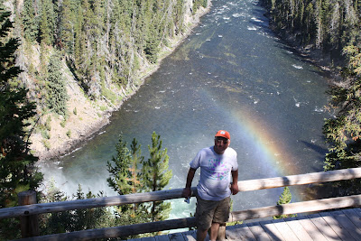
Our last day in the Park (might also have been Renee's last day as she is getting ready to pack up and head south in the next couple of weeks) is to visit the Grand Canyon of Yellowstone. It is pretty much in the center of the park and is spectacular. There are several waterfalls, but the most accessible are the Lower Falls, and that, of course also means lots of people.
We took a couple of side trips on the way and saw this bison just wandering down the road with no particular objective that we could see.
Did we break the 75 ft rule or did he? There was not 75 ft available!!

Once we reached the parking area there are several alternative trails that lead to better views of the canyon and the Falls. We hiked along the South Rim, it is about a mile or so each way with varying terrain but good (if sometimes loose) underfoot. 


There is a trail that Renee has taken that goes down in to the canyon, Uncle Tom's trail. It is short and steep descending about 500 ft in to the canyon with some 300 steps as well as steep downhill sections.As the information says. Easy going down but strenuous coming back up. I wimped out, and we took the trail that went along the South Rim with great views and more people. 


This tree is about to head in to the canyon. Maybe this year, maybe next.

We stopped and ate our lunch along the way and enjoyed a relaxing day that I would have otherwise missed. 
We arrived at Artist Point after a while and there was another parking lot there with lots of people. The view is all the way back up where we had hiked to the falls and gives a great perspective of the size and grandeur of the canyon. 


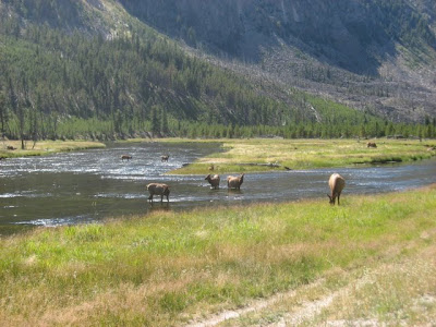
We headed back and, as mentioned sat in the traffic for a while, and then came across some elk grazing along a river bank with the now expected parade of cars and watchers. We participated. 
Once out of the park we stopped again at Renee's favorite spot on the Madison River just outside West Yellowstone. It is a magical place.

Enjoy

Saturday, September 4, 2010

Yellowstone Round 3. Driggs ID, Jackson WY, and South Yellowstone

Wednesday's continuing saga.
After Bechler falls we headed south (maybe south east) towards Driggs ID. Why you could rightfully ask!. Renee had heard there was a decent restaurant at the airport (I am always a sucker for a $100 hamburger) and a chance to see some WW2 vintage aircraft. The airport is remarkably big and busy with big hangars and good facilities including a 7000 ft runway. Someone explained that it is a less expensive alternaitve  to Jackson WY (Jackson Hole) on the other side of the range.
Lunch was excellent and there were 4 or 5 airplanes of interest so the trip was a success.
To get there we traveled through wheat and barley fields on grid roads that ran 180 degrees and either 90 or 270 degrees down to a highway and on to Driggs. I saw a sign for Kaufman Tire in Driggs. My son Alistair works for a Kauffman Tire Co in Atlanta. Not the same outfit in any way but worth a photo to generate comment!.

I am not sure what defines remote and compared to some places like the Dakotas but it is a long way from a big town. Driggs is on the western side of the Grand Tetons and in this pleasant agricultural valley.
The drive from Driggs and Victor is up across a pass that is steep and short (in western terms). Numerous warnings about hot brakes on trucks, and the consequences are dire. The truck runaway ramps are a LONG way away and you just do not want to do that.
Jackson is a nice town I am sure , but is crowded and full of the sort of people I do not like and I am sure they would rather I moved on as quickly as possible. The Grand Teton (AKA The large boobs) National Park is to the north and adjacent to Yellowstone. It is just north of the Jackson Hole Airport that looks like it would have a challenging and interesting approach, although not as much as Lukla in Nepal or Courcevel in France. (both are still on my list to experience)
Grand Teton Park is not as extensive as Yellowstone, but the sights are majestic (the eternal search for superlatives!).


 The highest peak is 13,770 ft and that puts it approx 6450 ft ft above the valley where I was taking the photos. There is still some snow in the very protected areas of the mountain. I wonder if you looked at photos from say the '60s whether you would see more snow, and maybe some visual evidence of global warming. Just a thought.


We looped around on a short road that took us to Jenny Lake in the park and it provided some great views as well.


Last view of the Grand Tetons from the north end across the Jackson Lake
It was already about 5.30pm and we were still about 150 miles from home, and it was not interstate!
The road north is a 2 lane road and the strictly enforced speed limit in National Parks is 45mph. There is a short gap between the parks, but it is a part of a National Forest.


Renee and me at the WY entrance. Photo courtesy of a couple from Virginia.

We re-entered Yellowstone, this time from the Wyoming side and headed up past Lewis Lake (after the Lewis and Clark expedition member) and the edge of Yellowstone Lakethe largest in the park.
On this road you will cross the Continental Divide three times, once at 7988 ft (2435m) once at 8391 ft (2558m) and again at 8262 ft (2518m). At some point (and I am not certain where) we came across temporary signs that stated "No Stopping for next mile" and of course around the curve there were cars stopped, some in the middle of the road.
There was a lot of animal activity, but the star of the show was a wolf who was wading around in the river. He was on his own and probably a couple of hundred yards away.
Looks almost like a bear. He was wearing a tracking collar (Renee's photo)


Headed up the creek (Renee's photo)
 
We saw other animals, particularly some bison that were wandering along the roadside at dusk. Not an encounter you want to have with a vehicle as they are LARGE.
The final event of the day was my joining the CDPC. For the Caterpillar folks who are reading, no this is not some random distribution center (in the Cat sense anyway) but the Continental Divide Peeing Club. Started by Renee a couple of months ago and I became the second member (as it were!) at the 8262 ft location. 
 
Clearly the photos is an "after" shot as I look distinctly relaxed!
We drove out of the park around 9pm and had been through entrances to the park in all three states. I suspect few know of the entrance from Idaho. 
We reckon that we drove around 350 miles that day. It was tiring but totally worth it and we gained a day to visit "The Grand Canyon of Yellowstone" That will be the next post.
 I am hoping to get current over this glorious Labor Day weekend.